Call For Enquiry
+977-9841390387

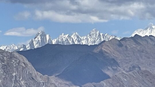
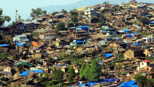
The Ghorepani Poon Hill Trek is a popular route for trekking in Nepal’s Annapurna region. This route is favored by those who have limited time or trekking experience. As it can be completed in 4-5 days and does not require significant physical fitness.
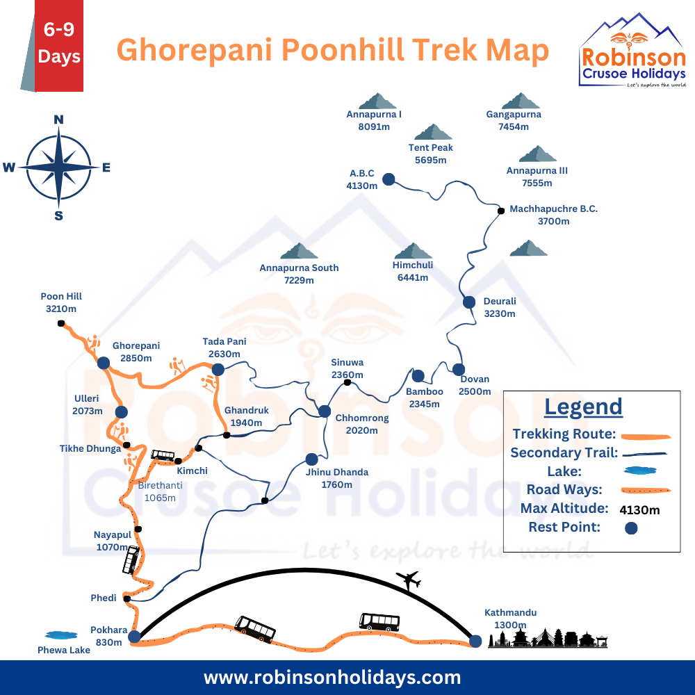
To ensure a safe and enjoyable trekking experience, it is highly recommended to use a map of the area. Even though the trail is well-marked and easy to follow. A map will help you navigate the route more efficiently and prevent you from getting lost.
In the Annapurna region, there are various types of maps available, including detailed topographic maps that show the terrain and elevation changes along the trail. You can purchase these maps in Kathmandu or Pokhara. Or you can use digital maps that can be downloaded onto your phone or GPS device.
In addition to using a map, it is also advisable to bring a guidebook or trekking guide that provides information on the trail’s distances, elevation changes, and recommended stopping points. This will help you plan your trek more effectively and ensure that you have a safe and enjoyable experience.
In conclusion, although the Ghorepani Poon Hill Trek is considered an easy route, it is essential to be well-prepared and use all available resources, including a map and guidebook, to ensure a successful and enjoyable trekking experience.
Brief Itinerary:
Day
- Drive from Kathmandu to Pokhara and stay over there.
- Drive from Pokhara to Birethanti and trek to Ulleri via Tikhedhunga.
- Trek to Ghorepani from Ulleri.
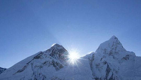
- Wake up early in the morning and hike to Poonhill(3210 meters) to have a sunrise view and then trek to Tadapani.
- Trek down to Ghandruk from Tadapani and explore the local area.
- Trek down to Birethanti via Sewai and drive to Pokhara.
- Drive to Kathmandu from Pokhara.
Detailed Itinerary
Day 1: Drive from Kathmandu to Pokhara and transfer to Hotel (7-8 hrs)
Early in the morning breakfast at the hotel
After breakfast drive from Kathmandu to Pokhara through the bank of Trishuli and Marshyangdi river
Upon arrival to Pokhara transfer to the hotel and refreshments
After refreshment explore the lakeside of Pokhara
Overnight at hotel
Day 2: Morning drive from Pokhara to Birethanti (1.5 hrs) and trek to Ulleri (2055 meters)
Early in the morning breakfast at the hotel
After breakfast drive from Pokhara to Birethanti and start the trekking up to Ulleri.
Upon arrival to Ulleri transfer to the hotel and refreshments
After refreshments explore the local area and local culture of Ulleri
Overnight at hotel
Day 3: Trek from Ulleri to Ghorepani (2850m/9350 ft) (5/6 hrs)
Early in the morning breakfast at the hotel
After breakfast start the trekking from Ulleri to Ghorepani
Upon arrival to Ghorepani transfer to the hotel and refreshments
After refreshments explore the local area and local culture of Ghorepani
Overnight at hotel
Day 4: Sunrise Poon Hill (3210m/10531 ft) then trek to Ghandruk (2170m/7120 ft) (6/7 hrs)
Early in the morning climb up to Poon Hill for a sunrise view
Then back to the hotel and have breakfast
After breakfast the trek from Ghorepani to Ghandruk.
Upon arrival to Ghandruk transfer to the hotel and refreshments
After refreshments explore the local area and local culture.
Overnight at hotel.
Day 5: Trek from Ghandruk to Birethanti (2/3 hrs) and drive to Pokhara (3/4 hrs)
Early in the morning breakfast at the hotel
After breakfast start the trekking from Ghandruk to Sewei and explore these areas
Then drive back from Birethanti to Pokhara
Upon arrival to Pokhara transfer to the hotel and refreshments
Overnight at hotel
Day 6: Drive from Pokhara to Kathmandu and transfer to Hotel (7-8 hrs)
Early in the morning breakfast at the hotel
After breakfast drive back from Pokhara to Kathmandu
Upon arrival to Kathmandu transfer to the hotel and refreshments
Overnight at hotel
Our service for our guest
Multi-day Tour

Yoga Tour in Nepal Brief Insight
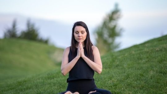
Yoga physical is a mental and spiritual practice or discipline which originated in ancient Nepal. Yoga is one of the six Astika (orthodox) schools of Hindu philosophical traditions. Yoga Tour in Nepal is a great experience in the Himalayas.
Outline Itinerary
- Day 1: Arrive in Kathmandu or your Destination
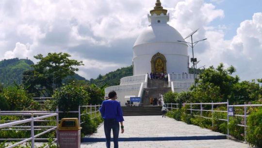
- Day 2: Visit Buddhanilkanth, Kapan and Bauddha Nath
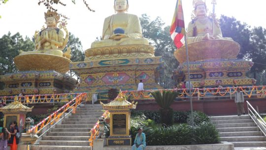
- Day 3: Visit Namobuddha, Panauti and Bhaktapur
- Day 4: Visit Chovar, Pharping, Kirtipur and Swyambhu
- Day 5: Drive from Kathmandu to Pokhara and explore
- Day 6: Explore Pokhara then Drive from Pokhara to Kade and hike to Australian Camp
- Day 7: Trek from the Australian camp to Sarankot via Kaski Kot
- Day 8: Sarankot to Pokhara then back to Kathmandu
- Day 9: Final departure
Everest Region
Please go to our Plan Trip or Customize Trip according to your time duration and schedule.
Therefore, Robinson Crusoe Holiday is always ready to provide excellent services for our guests. Based on our cultural motto “Matri Debo Bhaba, Pitrii Debo Bhaba, Atithi Debo Bhaba.” Thus, the Mother is a God, the Father is a God, and the Guest is a God.