Call For Enquiry
+977-9841390387

The Langtang Valley Trek is a well-known trekking route in Nepal that is famous for its stunning mountain views and unique cultural experiences. The trek takes trekkers through the Langtang National Park, where they can witness the breathtaking views of the Langtang range, including Langtang Lirung, Gang Chhenpo, and Dorje Lakpa.
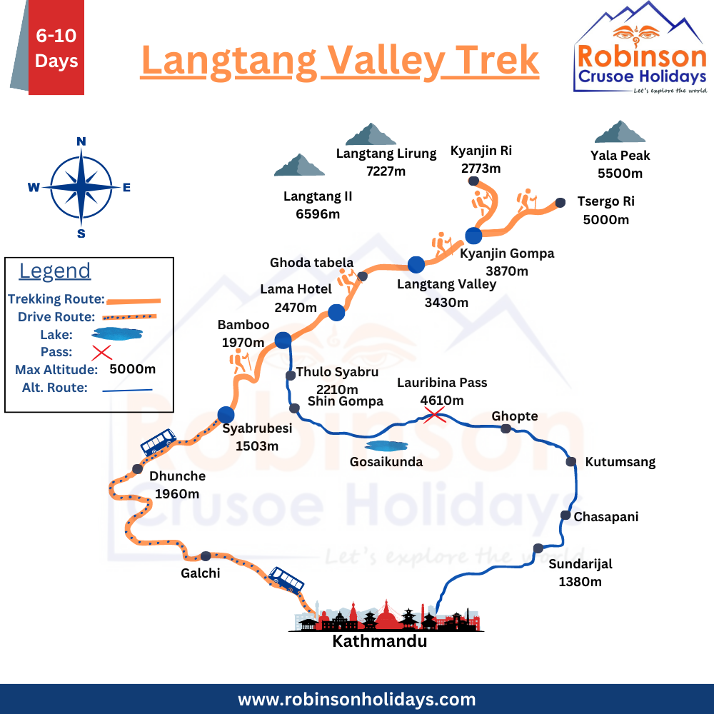
Maps are essential for trekkers who are planning to trek to Langtang Valley. The most commonly used maps are the Langtang National Park Map and the Langtang Trekking Map, which provide useful information on the trekking route, elevations, landmarks, and other relevant details.
The Langtang Trekking Map typically contains information such as the trekking route from Syabrubesi to Kyanjin Gompa, altitude profiles of the trekking route, the location of accommodations like teahouses and lodges, water sources, rest stops, landmarks, and emergency contact information.
Aside from using maps, trekkers may also utilize GPS devices or mobile apps to track their progress and location while trekking. However, it is important to note that maps should not be entirely relied upon, and it is advisable to carry a paper map as a backup.
Moreover, it is essential for trekkers to have a good understanding of the terrain and weather conditions when trekking to Langtang Valley. Therefore, hiring a local guide or porter who is familiar with the trekking route and the terrain can be advantageous for a safe and enjoyable trekking experience.
Langtang Valley Trek Map
▪️Trip Days: 7 Days
▪️Max-Elevation: Kyangin Ri(4773 Meters)
▪️Best Seasons: Autumn & Spring
Langtang Trek Itinerary
- Day 1: Drive from Kathmandu to Syabrubesi(5-6hr drive)
- 2: Trek from Syabrubesi to Lama Hotel.
- 3: Trek from Lama Hotel to Mundu.
- 4: Trek from Mundu to Kyanjin Gumba and explore the area.
- 5: Trek to Tserko Ri and trek back to Langtang Valley.
- 6: Trek down to Bamboo/Syabrubesi from Langtang Valley
- 7: Therefore, drive to Kathmandu from Syabrubesi.